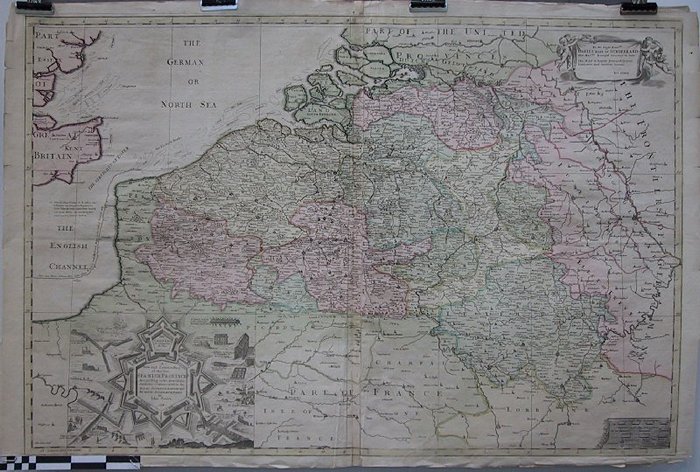
A New and correect Map of the Ten Spanish Provinces according to the New Observations comunicated to the Royal Society at London and the Royal Accadem

CARLKXX00062
Kaart van huidige België met grensgebieden
Linksonder inzetstuk met alle onderdelen van een fort Tekst rechtsboven: `To the Right Honoble Charles Earl of Sunderland Her Maj.tes Principal Secretary of State. This map is humbly Dedicated by your Lordschips most obedient servant. Ion Senex Tekst links : `NB That all Maps Printed for H. Jalliot and P. Mortier and Brought to England for Corret Maps are only Copies from Sanson with all his Errors and several by themadded not to be found in Sanson
Gravure 100 X 67 cm Ingekleurd Plooi in rugzijde verstevigd Gekartelde randen
Common English Miles 60 in a Degree Measuered English Miles 70 in a Degree Dutch Miles 15 in a Degree
Kaarten plattegronden en plannen
Landkaarten
1714
John Senex